Spatiotemporal Program – V1 Makassar Sea Reclamation in South Sulawesi
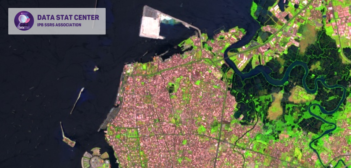
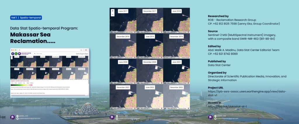

The South Sulawesi Provincial Government has a land reclamation project and this plan is contained in the Makassar RT/RTW Handover Regulation No. 4 of 2015. The sea reclamation was built to provide land for urban development with a reclamation target area of 4,000 ha which is planned to be built in coastal areas and Small islands are designated as reclamation targets.
Until 2022, the total land area of Makassar sea reclamation is 91.85 hectares or 2.23%. Around 3908.15 hectares are still needed to achieve the development target of 4000 hectares in 2034. Currently, the officially announced reclamation objects are the Centers Point of Indonesia (CPI) and Makassar New Port (MNP).
The CPI project is owned by the Regional Government of South Sulawesi Province (@sulselprov). Meanwhile, the MNP project is managed by PT Pelindo (@pelindo) and coordinated by The Committee for Acceleration of Priority Infrastructure Delivery (KPPIP) (@kppip).
The monitoring method uses sentinel-2 satellite imagery with a composite band, namely SWIR-NIR-RED (B11-B8-B4).
.
Long life research Indonesia!
—–
1/C/1/2/5
#makassarreclamation
#webgis
#datastatcenter
#ipbssrsassociation
Direktorat Media Publikasi Ilmiah, Inovasi, dan Informasi Strategis
IPB SSRS Association
Instagram : @data_stat
Email : publikasiipbssrs@gmail.com
Narahubung : Lenny (@sheis.lenka)