
Spatiotemporal Program – V8 Lapindo Mudflow on Sidoarjo Regency
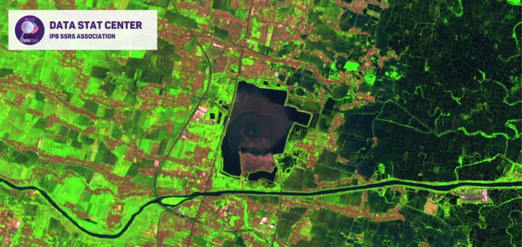
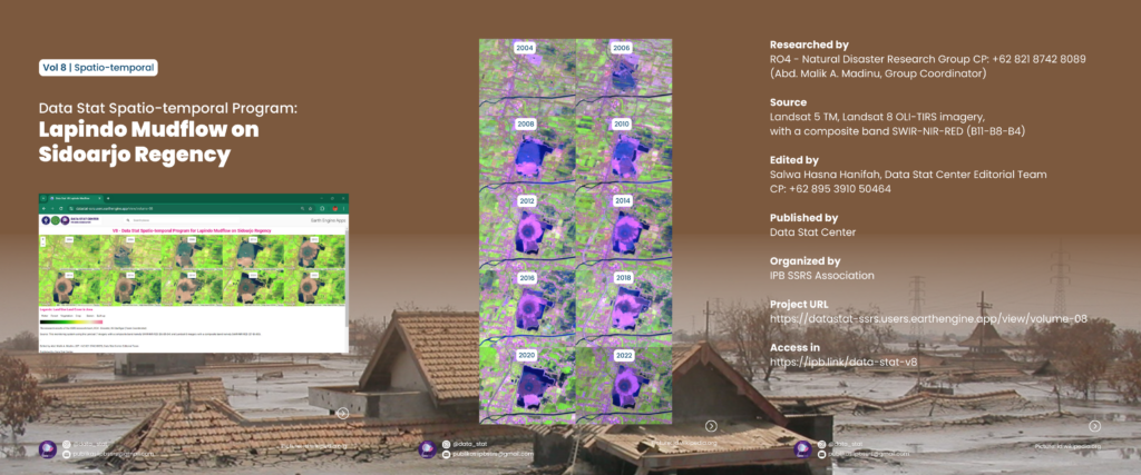

The Sidoarjo mud flow, also known as Lumpur Lapindo, is an ongoing environmental disaster in East Java, Indonesia. The mud flow resulted from an erupting mud volcano in the subdistrict of Porong, Sidoarjo. Responsibility was assigned to the blowout of a natural gas well drilled by PT Lapindo Brantas, although company officials contend it was caused by a distant earthquake in a different province. At its peak, it spewed up to 180,000 cubic meters (6.4 million cubic feet) of mud per day. Currently, the discharge rate is about half that amount, but it is expected to continue for the next 25 to 30 years.
Mud volcano systems are common in Indonesia’s East Java province. The basin beneath Java contains over-pressured marine carbonates and muds, leading to mud volcanoes. The Sidoarjo area is known for oil and gas reserves, making it a major concession area for exploration. Despite containment efforts, the mud flow still disrupts local areas, and further breakouts are possible. The disaster continues to impact the region even after 15 years.
.
Long life research Indonesia!
8/C/16/6/26
webgis
datastatcenter
ipbssrsassocation
IPB SSRS Association
Instagram : @data_stat
Email : data-statssrs@apps.ipb.ac.id