Spatiotemporal Program – V4 Limboto Lake in Gorontalo
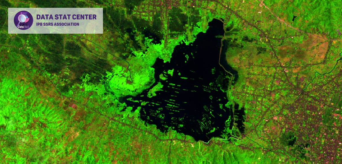

Limboto Lake is a lake located in Limboto District, Gorontalo Regency, Gorontalo Province, Indonesia. This lake has a depth of between 5 to 8 meters, and visitors or tourists can enjoy various activities, including fishing, boating competitions, or swimming. In addition, they can also enjoy fresh grilled fish provided by the local fishing community at a relatively low price.
Limboto Lake is wide from year to year and its depth level continues to decrease. The area of Limboto Lake in 1999 ranged from 1,900-3,000 ha, with a depth of 2-4 meters. In 1932, the area of these waters reached 7,000 ha.
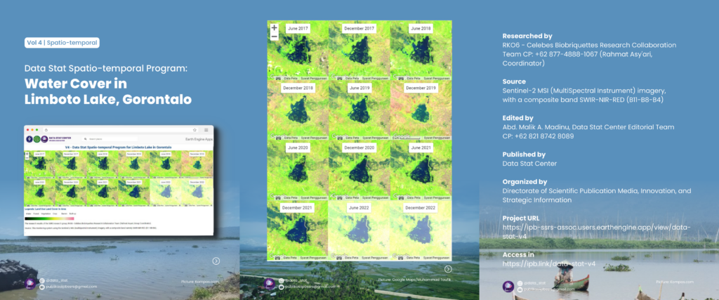
What is the current area of Lake Limboto? Check out the results of our spatiotemporal monitoring and look forward to the latest Limboto Lake area in the next #infographic #datastatcenter post.
The monitoring method uses sentinel-2 satellite imagery with a composite band, namely SWIR-NIR-RED (B11-B8-B4).
.
Long life research Indonesia!
—–
4/C/16/3/14
#limbotolake
#gorontalo
#webgis
#datastatcenter
#ipbssrsassocation
Directorate of Scientific Publication Media, Innovation, and Strategic Information
IPB SSRS Association
Instagram: @data_stat
Email: publikasiipbssrs@gmail.com
Contact person: Lenny (@sheis.lenka)