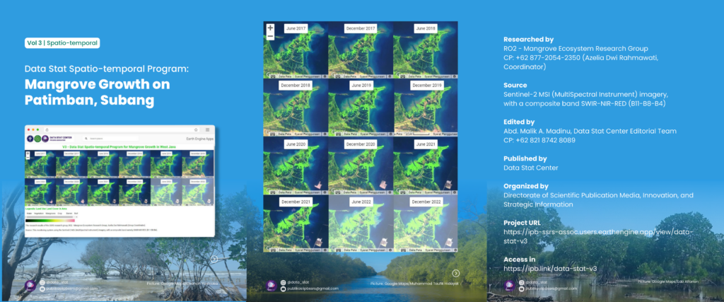
Spatiotemporal Program – V3 Mangroves Growth on Patimbang, Subang Regency

Ecologically, mangrove forests can guarantee the maintenance of the physical environment, such as breaking waves, wind and sea water intrusion, as well as being a breeding ground for various types of marine life such as fish, shrimp, crabs and other types of animals. In terms of its function, mangroves play an important role for coastal areas to serve as a link between land and sea, such as dampening natural phenomena caused by waters, such as abrasion, waves, storms, and also as a buffer for other marine life which is the source of the surrounding community.
At the seedling level, the highest density of mangrove trees was in Patimban Village (Pusakanagara District), namely 2500 seedlings/ha. Based on the density results it was found that the mangroves in Patimban Village were included in the Criterion Damaged (rare) with a mangrove density value (trees/ha) < 1000, this was supported because Patimban Village was still in the seedling phase and some had not yet grown become a tree.
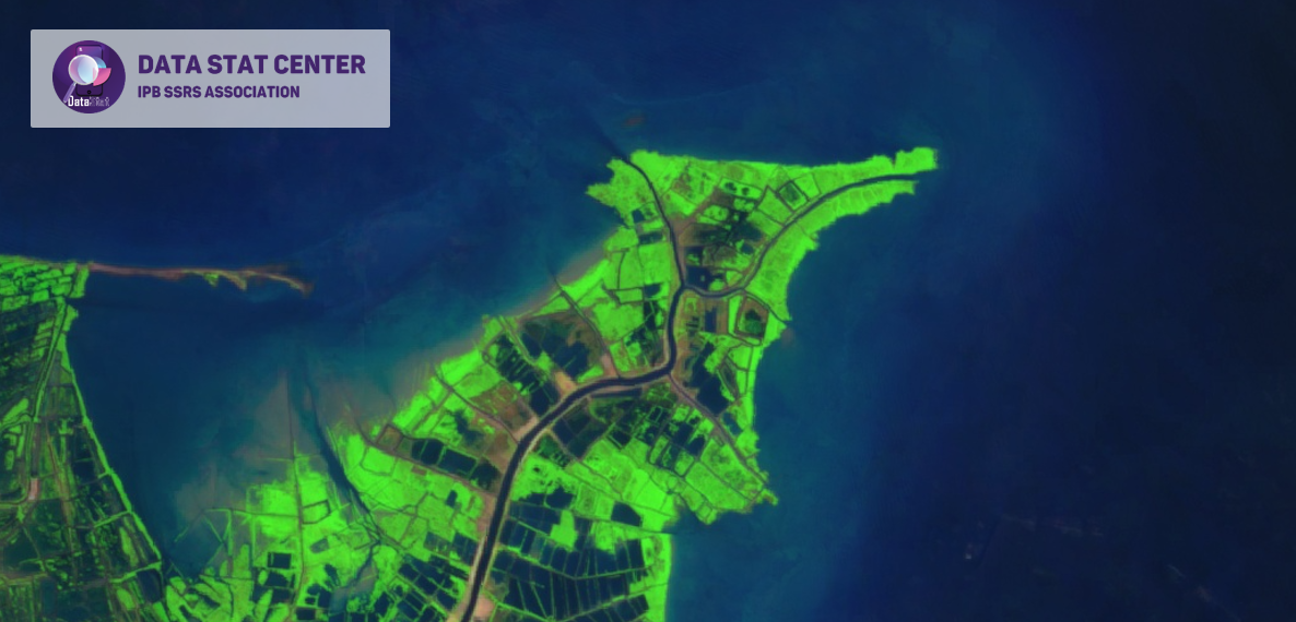
The monitoring method uses sentinel-2 satellite imagery with a composite band, namely SWIR-NIR-RED (B11-B8-B4).
.
Long life research Indonesia!
—–
3/C/20/2/11
#mangrove
#patimban
#webgis
#datastatcenter
#ipbssrsassocation
Directorate of Scientific Publication Media, Innovation, and Strategic Information
IPB SSRS Association
Instagram: @data_stat
Email: publikasiipbssrs@gmail.com
Contact person: Lenny (@sheis.lenka)